GlassOcean
Solutions

The Ultimate Maritime Intelligence Solution.

GlassOcean provides a fully integrated maritime intelligence solution, offering real-time vessel tracking, weather analytics, security risk assessments, and environmental monitoring — ensuring safer navigation, optimized resource allocation, and a more secure maritime environment.

0+ years
Experience & Quality
0K+ vessels
Enhanced Situational Awareness
0+ sources
Comprehensive Data Coverage
0 tools
Customizable Alerts & Reports

Situational Awareness

Provides a unified, real-time intelligence picture of all maritime activity — from vessel anomalies and illegal fishing to piracy and natural disasters. Leverage this critical insight to proactively secure assets, mitigate high-stakes risks, and ensure immediate command-level decision-making.
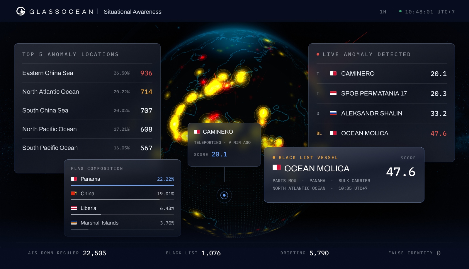
  • Live anomaly detection across all vessel types
  • Illegal fishing, piracy & natural disaster monitoring
  • Blacklist vessel identification & flag composition analysis
  • Top anomaly location ranking with real-time severity scoring
Explore situational awareness
GlassOcean situational awareness console: a globe of live anomaly clusters ringed by the top five anomaly locations, the live detection feed, flag composition, and a blacklisted vessel card.

Meteorology & Oceanography

Maximize operational excellence with our advanced Meteorology and Oceanography platform. Gain unprecedented clarity through real-time data on wave height, wind speed, and sea temperature. Instantly transform risk mitigation and proactively optimize every maritime venture.
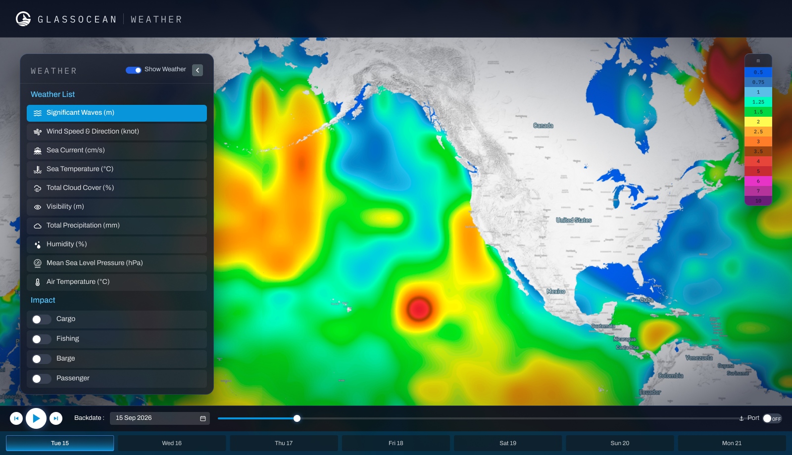
  • Real-time wave height, wind speed & sea temperature
  • Route weather overlay for voyage planning
  • Risk mitigation forecasts for high-stakes passages
  • Historical oceanographic trend analysis
Explore meteorology & oceanography
GlassOcean weather console: a significant wave height field across the North Pacific and the western Atlantic with the layer list open on Significant Waves, per-vessel-type impact toggles, a wave-height scale in metres, and a seven-day forecast strip.

Smart Fishing Hotspots

Our system uses predictive models and habitat mapping to optimize fishing efforts by identifying high-potential zones. This approach ensures sustainable resource management and leads to significantly improved catch efficiency for fishing fleets — maximizing yield while maintaining sustainability.
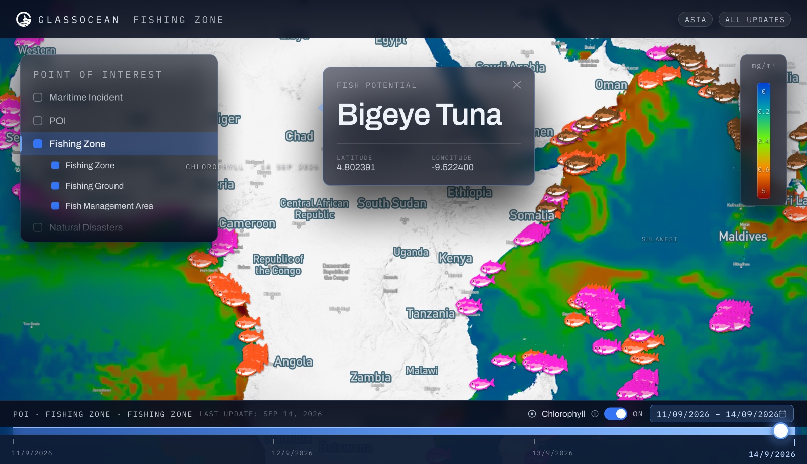
  • AI-driven habitat mapping for target species
  • High-potential zone identification & ranking
  • Sustainable resource management indicators
  • Real-time fishing hotspot updates by region
Explore fishing hotspots
GlassOcean fishing zone console: a chlorophyll concentration field stretching from West Africa to the Indian Ocean with fishing grounds plotted across it, a point-of-interest layer panel, a fish potential card naming bigeye tuna with its coordinates, and a four-day timeline scrubber.

Maritime Security & Environmental Protection

Harnessing advanced satellite technology, our platform delivers real-time insights to uncover hidden vessels and detect environmental threats like oil spills. With fast, accurate analysis, it empowers smarter decisions, stronger maritime security, and a cleaner, more sustainable ocean.
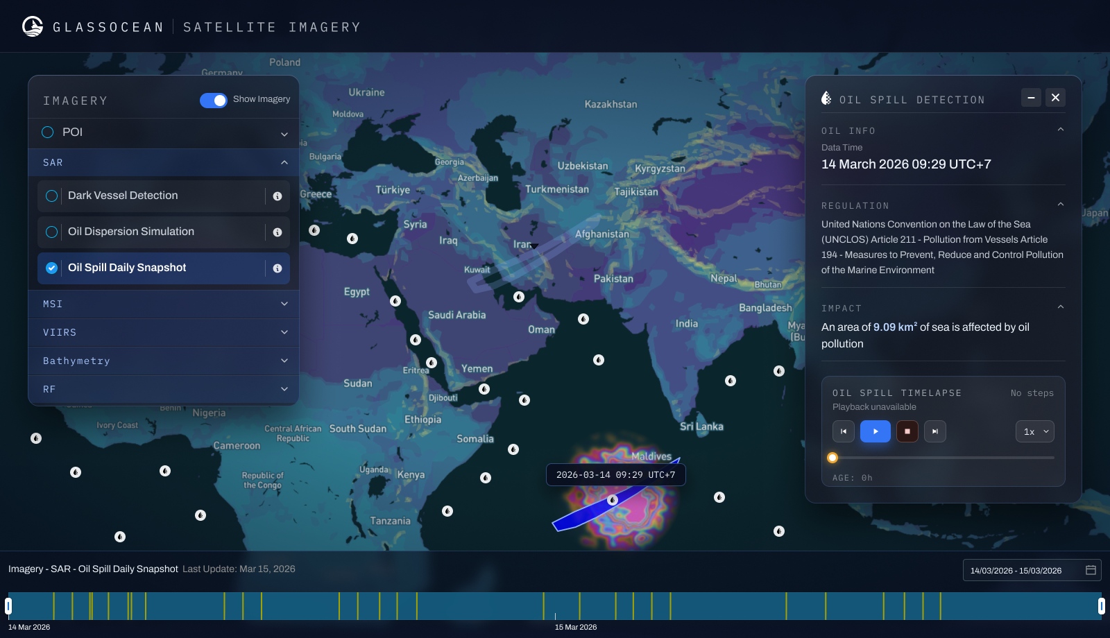
  • Dark vessel detection via SAR satellite imagery
  • Oil spill identification & affected area calculation
  • UNCLOS Article 211 violation flagging
  • Environmental threat reporting with regulatory reference
Explore maritime security
GlassOcean satellite imagery console: a SAR oil spill daily snapshot over the Indian Ocean with a detected slick south of the Maldives, the imagery layer tree, and an oil spill detection panel citing UNCLOS Article 211.

Naval System Intelligence

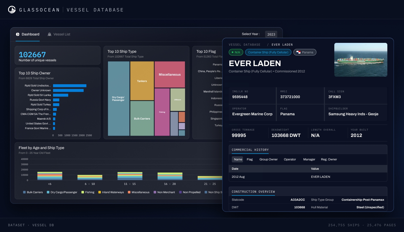
Our system provides detailed profiles of foreign military vessels, including weaponry, navigation, and communication systems, to enhance maritime security and strategic planning. Integrated data enables proactive threat monitoring, smarter decision-making, and efficient operations.
  • Foreign military vessel profiles with capability data
  • Weaponry, navigation & communication system details
  • Top 10 country fleet tracking by vessel class
  • Strategic threat monitoring & early warning
Explore naval intelligence
GlassOcean vessel database console: a fleet dashboard counting 102,667 unique vessels with top ten ship owner, ship type and flag breakdowns, and an open vessel record for the Panama-flagged container ship EVER LADEN.

Coastal Surveillance System

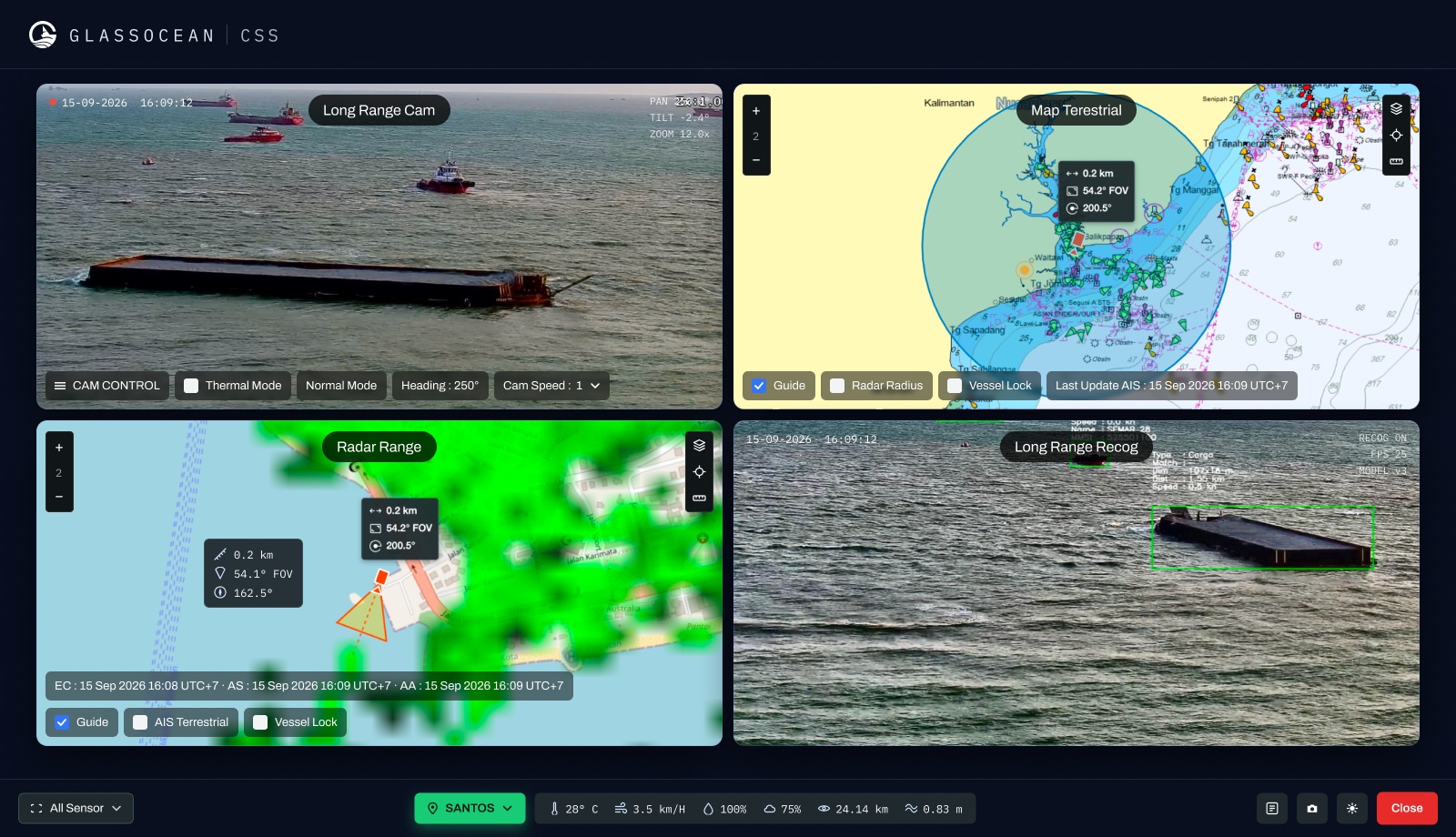
Our system integrates AIS, radar, and long-range cameras for real-time vessel tracking, enhancing situational awareness and security. Using multi-sensor technology, it improves threat response, border protection, and maritime monitoring.
  • AIS + radar + long-range camera fusion
  • Real-time vessel identification at coastal boundaries
  • Multi-sensor cross-validation for threat confirmation
  • Border protection & maritime monitoring integration
Explore coastal surveillance
GlassOcean coastal surveillance console: a long-range camera holding a capsized barge, a terrestrial AIS chart of the Balikpapan approaches with the sensor's radar radius drawn on it, a radar range overlay, and the long-range recognition feed boxing the same hull.

The ocean doesn't wait.
Neither should you.

GlassOcean gives your team the visibility, intelligence, and tools to act faster — and smarter — on every maritime decision. See it live with a personalized demo.
